
County High Point: Kippure (14/32)
County: Dublin
Height of high point: 757m
Our total elevation for the hike: 378m
Difficulty: Easy / Moderate
If you follow the mast road up and down, this is an easy route. If you take the same route as we did (crossing between the two Lough Brays’), it crosses to moderate. There is quite a worn route through between the two lakes, but being boggy it can be hard to cross if it’s been wet. There is no trail for the second half of the bog section.
Learn more about trail and hillwalking grades here.Our route distance: 8.6km
Views: Splendid sunsets

I paced past the pile I was amassing in the middle of our upstairs floor. I’d always liked the aesthetic of outdoor gear laid out in neat piles for a photo before someone’s long trip or weekend adventure - but I’d never realised how well it could be utilised for the actual packing part. Finding our buffs was the current mission as I entered our bedroom. Standing by the bed, I look around and try to decide where I might have thought they “belonged” the last time I did laundry.
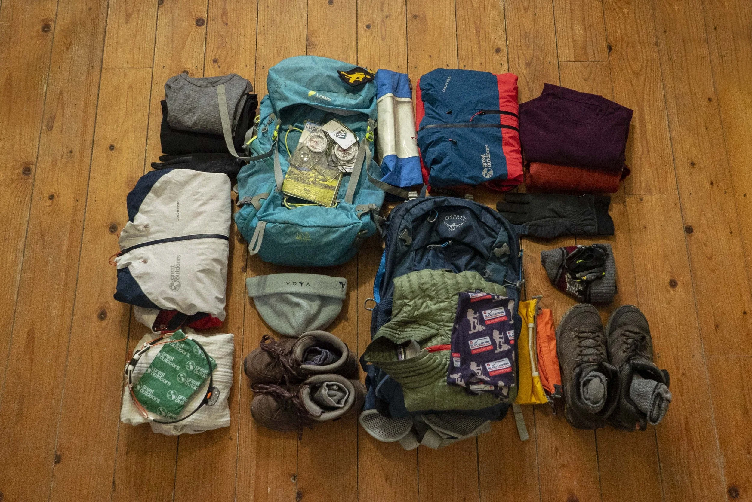
I didn’t have much time left to find our bits and pieces, as it was already approaching lunch time and we needed to be on the road sooner rather than later. That weekend, we were doing our Mountain Skills 2 course with Fia Mountaineering in the Wicklow Mountains, and seeing as we were driving to the east coast anyway, I’d persuaded Carl that the perfect start to our weekend of training would be to do a quick hike the night before.
Kippure sits right on the edge of the Dublin and Wicklow Mountains, pushing the border of Dublin to it’s most southerly reaches. At 757m tall, it’s technically at the higher end of the County High Points List, but like many hiking routes in the Dublin and Wicklow mountains, the starting point for trails is much higher than sea level, so the overall climbing was less than 400m.
We decided to follow a pretty common looped route; parking on the Old Military Road at the Lough Bray Parking point, and climbing up between Lough Bray Upper and Lough Bray Lower. As we got out of the car and pulled on some extra layers to counter the cold February winds, a few other people pulled over to hop out and take in the view. No one else was actually heading up the hills though.
Crossing the road, there’s a short descent to the boggy valley floor, before following the well worn path through the bog. You walk right along the side of Lough Bray Upper, before reaching the one steep climb of the route. I found that it looked steeper and more technical on the approach than it was once we started up, but it still requires care. Once up this small scramble, we were onto the upper plateau above both of the lakes.


This is where the worn path ends, and we set off into the bog heading west / south-west towards the summit of Kippure. In clear weather, the large mast on top is a pretty clear beacon.
The mast on the summit is is the oldest television transmission site in Ireland, and as we approach wisps of cloud make it look other worldly. As we reached the top we split up, Carl declaring a race to see which of us would find the trig point first. As we each went our different ways around the mast site the sun began to set, the sky of icy blue slowly painted with warming oranges.
Hunkering down my the trig point we take in the view, and then decide that the wind is cold and it’s time to call it a night.


Because there is a mast, there is also a mast access road that can bring you the whole way to the top without leaving tarmac (although this doesn’t mean you can drive up, the access road is gated at the base). If you approach the way we did, note that crossing over onto the road would be hard as there is a deep ditch running between the road and this eastern side of the bog.
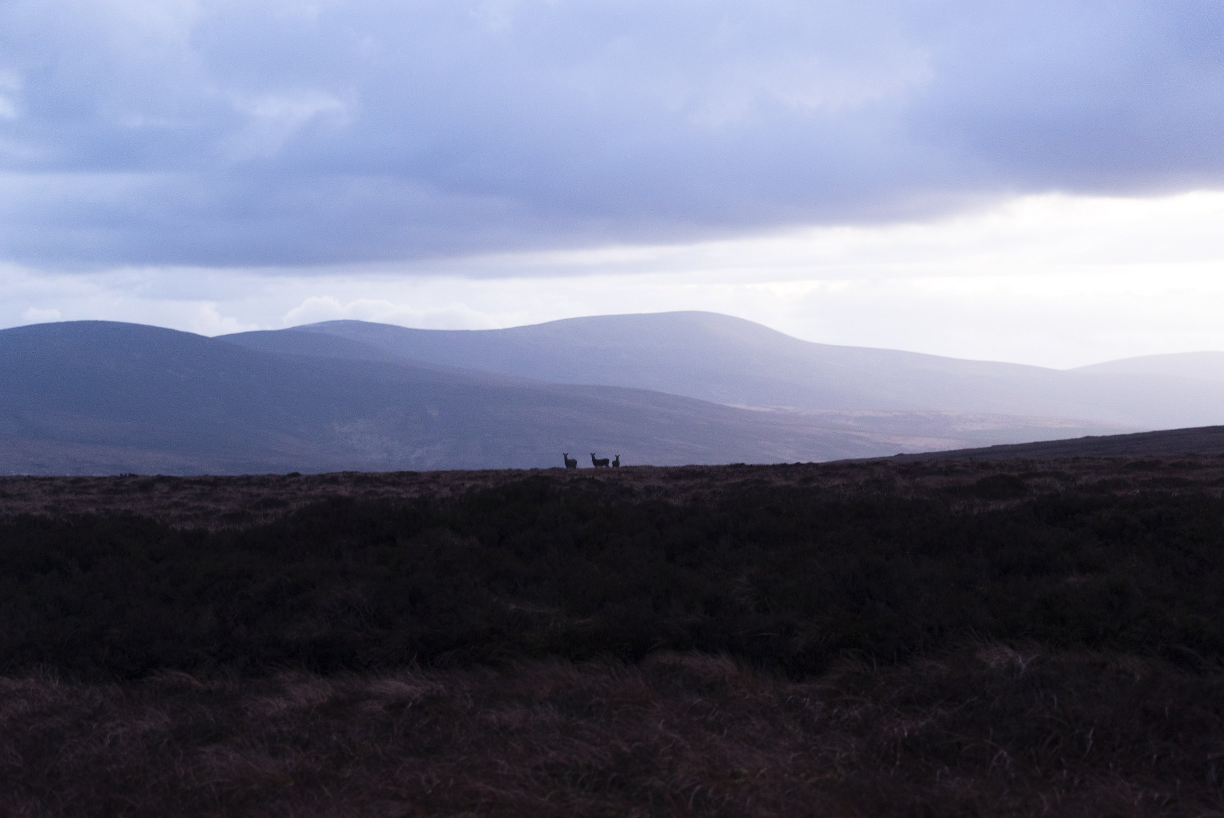
For us, descending the mast road was a great route down - we had the fun of hiking up through the bog, and then could pretty quickly walk down to the road (the mast road is about 3.5km long). In the darkening twilight, deer followed us down the side of the hill, leaping over the soft ground like it was as easy to traverse as the tarmac we were on.
At the bottom we rejoined the R115 / Military Road for around 1km before making it back to where we had parked.


If you want a full overview of the County High Point’s project, click here.
For a breakdown of trail and hillwalking grades, click here.