
County High Point: Moylussa (13/32)
County: Clare
Height of high point: 531m
Our total elevation for the hike: 565 m
Difficulty: Easy
Learn more about trail and hillwalking grades here.Our route distance: 11km
Views: Spectacular
Moylussa (531m) is the highest point in Co. Clare. Sitting on the western banks of Lough Derg, this peak is part of the East Clare hills. We travelled down from our corner of the north-west to take on this hike in mid-January, our first proper hike of 2023. As we drove south along that western shoreline of the lake, I felt so happy to have chosen this particular hike for that day; passing through Whitegate and weaving along the small back lanes of that area, had us criss-crossing the East Clare Way, a trail I didn’t realise I had such fond memories of.
For Moylussa itself we headed to the village of Twomilegate, and from there to Ballycuggaran Forest Car Park. Twomilegate sits right on the banks of Lough Derg and has plenty of parking on the lakeshore, for those looking to start from the lowest point possible. We decided to head up to Ballycuggaran forest car park, the car just about making it up the couple of steep gravel switch-backs to the parking area. A classic large Coillte car park, there’s room ample room (30+ cars).
Wrapped up in many layers, we set out from the car park along the East Clare Way. This section is a narrow trail that cuts a straight line up the hill, with breaks in the hedging offering spectacular views out at the lake. There are some opportunities along here to use the wider Coillte logging roads and follow their switch-backs for a less intense ascent.


For our outbound journey we stuck to the “straight up” approach, the first one or two kilometres on the narrow trail, then onto some of the wider tracks. After what had been a pretty mild winter for the end of 2022, the beginning of 2023 was when the cold truly set in, and our hike had the rare and exciting occurrence of snow! The crunchy white layer added an extra element of child-like joy, and our climb passed pretty quickly.
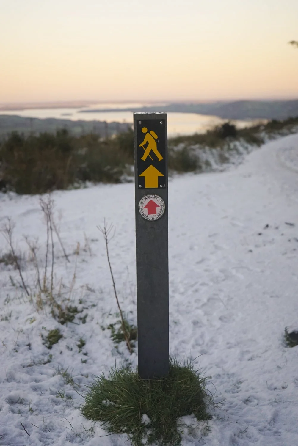
Looking up other people’s accounts of this route before we headed out, one of the key points was to not miss the point where a small, hand-made sign points you off the forest tracks and off to the summit. However, we seem to have lucked into tackling this list at the perfect moment - a new Coillte sign clearly marked the turn up, and the trail from there to the top was well maintained.


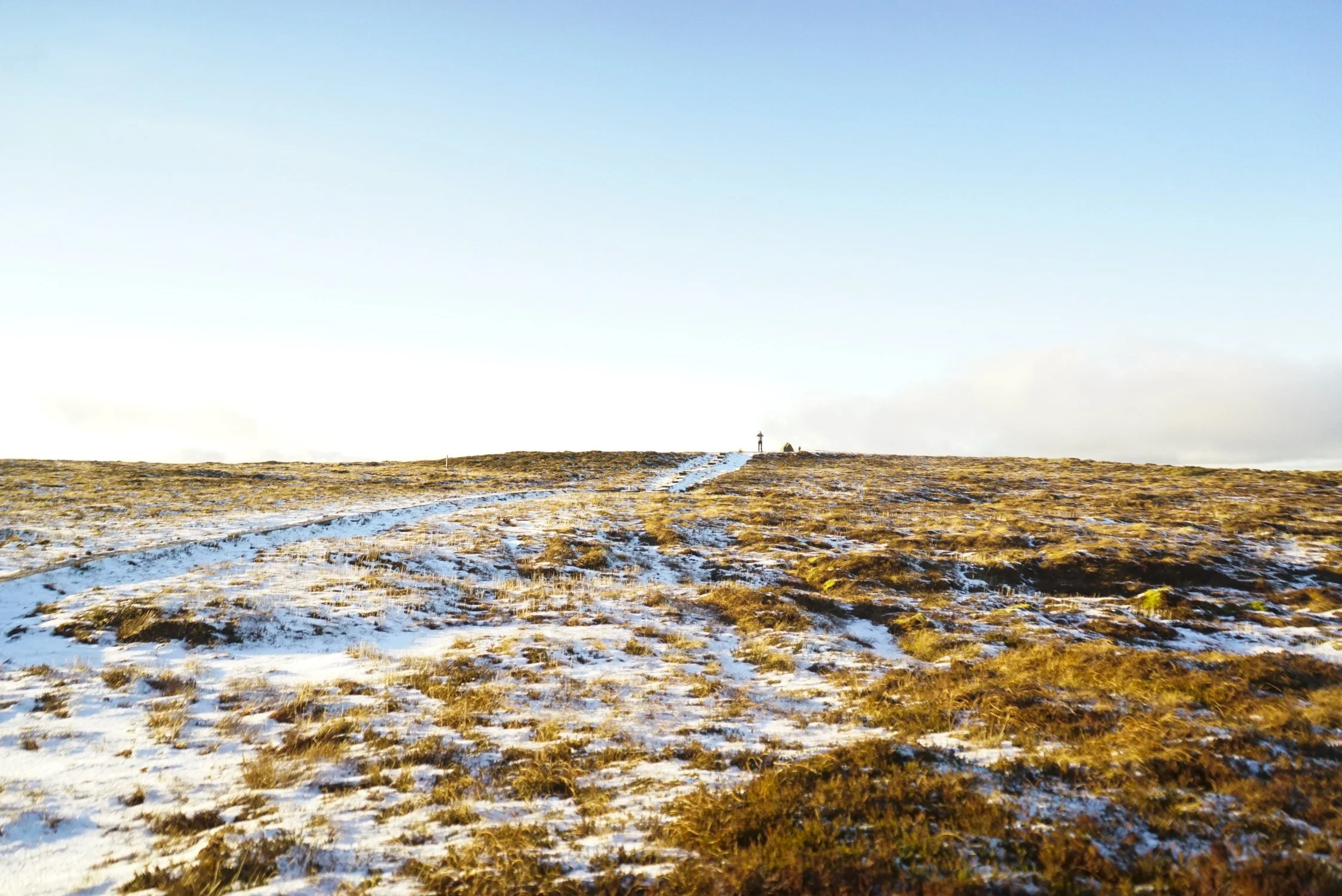
Heading up from this turn, it’s about 1500m to the summit. The first 1km is along a widened trail, with the final summit crossing following a twisting boardwalk (also known as a bog bridge). We crossed this beautifully frozen wonderland as the sun slowly sank towards the horizon, soaking the world in golden light.


The summit itself is marked with a plaque attached to a large rock. As we took in the views and talked about how beautiful the place was, two more walkers made it to the summit, shared a quick chat with us, and then they headed down. We delayed as long as we felt like the light would hold out for our descent, and then turned back along the boardwalk.


On our descent we took one of the forestry road switch-backs, as opposed to the narrower trail that we’d climbed up along, as we knew some of those sections would be very icy as the temperatures dropped with the setting sun.


Making it back to the car as darkness swallowed the trees around us, we did some quick filming, and then started the two and a half hour drive home.
Favourite near-by places:
The Garden Cafe at the East Clare Community Co-Op:
Every time we pass through here, we stop at the Garden Cafe in Scarriff. But it’s not just a fantastic cafe (who’s veg is supplemented by the Community Garden at the back of the cafe), as you walk in off the street, you can meander through the co-op’s second hand shop filled with books, clothes, and antique furniture pieces. The place feels like a welcoming space, and really seems like it has become the community hub it strives to be.
The Garden Cafe on Google Maps.Lakeside Holiday Park Campsite
Ever wanted a campsite right on the water, with quiet piers and lush trees? This is what we found when we walked down to this campsite while walking the East Clare Way. When we stayed in the summer of 2019, we arrived on a weekday and had most of the campsite to ourselves. It was ACSI accredited, which is something we look for when searching for campsites as it typically means a campsite of a high quality, but also one that has a feeling of connection to the place around it.
The Lakeside Holiday Park on Google Maps.Indoor accommodation Clare Ecolodge, Feakle
We stayed at Clare Ecolodge when walking the East Clare Way, and had an amazing evening swapping adventure stories with the owners. They are striving to produce all their own power and become carbon neutral, as well as growing all their own veg and herbs that they use in their kitchens.
The Clare Ecolodge on Google Maps.
Watch our video of the hike here.
Learn more about Moylussa on Mountain Views.
If you want a full overview of the County High Point’s project, click here.
If you want to learn more about trail and hillwalking grading, click here.